The small town of Locmariaquer in French Brittany is home to a set of Neolithic structures that are among the most significant in Europe.
In the complex, located about 12 kilometers from Carnac, three stand out in particular:the Er Grah corridor tomb-type tumulus , the dolmen of the Table des Marchands (Traders table ) and the Party Menhir . The latter is considered the largest monolith or stone block ever transported and erected by Neolithic peoples.
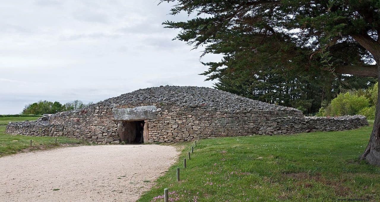
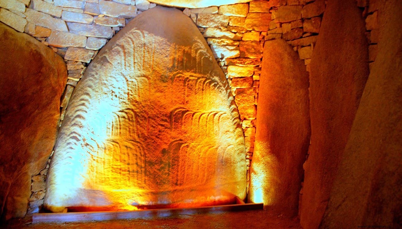
The Table des Marchands It is a large dolmen in which various decorative motifs have been found. In the main chamber there is a huge carving of an ax in its lower part, as well as a partial representation of an ox-drawn plow.
Precisely this fragment seems to have belonged to the Broken Menhir, since the design coincides with the existing carvings in the broken areas. Other fragments were found in different parts of the tumulus, as reused materials, and even in the Gavrinis dolmen, located on a nearby island.
The dolmen was excavated and rebuilt in 1993, restoring its original appearance, protecting it with a cairn (mound of stones).
Precisely as a cairn would have been erected the Er Grah Burial mound around the 5th millennium B.C., which presents the typology of a passage tomb with about 140 meters in length. Analysis of its roof has confirmed that the structure was completed around 3300 BC
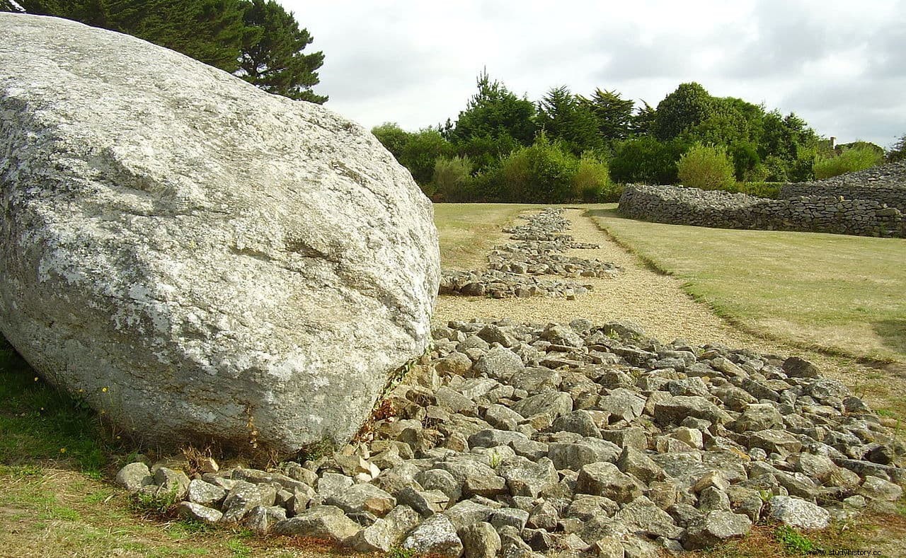
But the most singular of the Locmariaquer structures is the Party Menhir . With its impressive 21 meters in height and 330 tons in weight, it is considered the tallest of the monoliths erected in Europe in Neolithic times (as a comparison, the tallest stones of Stonehenge reach about 7 meters). The quarry from which it was extracted has even been identified, in Auray some 10 kilometers away from the place, which once again leaves questions about the method used to transport it.
Its entire surface is decorated with incisions that resemble plow furrows, although currently very eroded and difficult to see. Hammers and stone scrapers were used to smooth the surface once the monolith had already been erected, because the base that remained buried shows no tool marks.
The fact is that it should not be unique, because next to its location there are 18 other graves that, according to Charles-Tanguy Le Roux, could contain similar structures, forming an alignment. This would extend about 55 meters in a straight line to the north (no excavations have been carried out beyond that, so more could appear).
It is estimated that it was erected around the year 4500 BC, but some two or three centuries later it was demolished and broken into the four fragments that can be seen today. The cause is unknown, some theories point to an earthquake (hypothesis confirmed by computer models), or a lightning strike, and authors such as Rabiger believe that the destruction was deliberate.
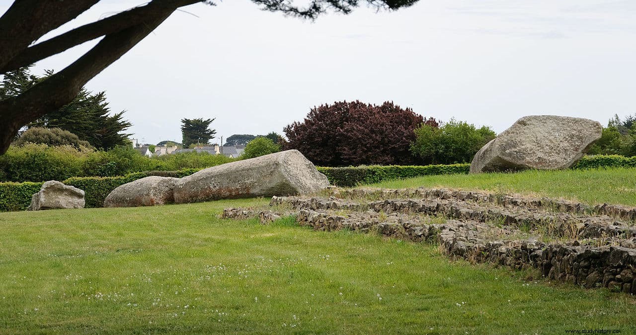
His theory is that in the area these types of monoliths would have been associated with specific individuals, social or religious leaders, and on their death they were destroyed. It was also initially noted that the monolith was never erect, but archeology has confirmed that it was. What is known is that the rest of the pieces that made up the alignment were removed and reused in other constructions such as tombs and nearby dolmens.
A fact that reinforces the deliberate destruction is that the breaks occurred in a straight line, with flat cutting surfaces, as if they had been previously prepared by means of notches.
It is also not known exactly what its function was. The alignment could be used, as Professor Alexander Thom indicates, to calculate the lunar cycle of 18.6 years, but other authors completely rule out its use for astronomical purposes.
Some consider it the boreal column cited by the Greek geographer known as Pseudo-Scymno in the late 2nd century BC. in the description of the Mediterranean world written for King Nicomedes II of Bithynia. But there is no evidence to support this claim.