In 1941, US President Franklin D. Roosevelt had a difficult outlook ahead of him, such as maintaining the neutrality of the United States in World War II. At least that was the promise he had made to his citizens only a year before. In practice, US aid to the Allies was already being developed in many respects. And Roosevelt himself was probably regretting what he said, given the advances of the Nazi regime.
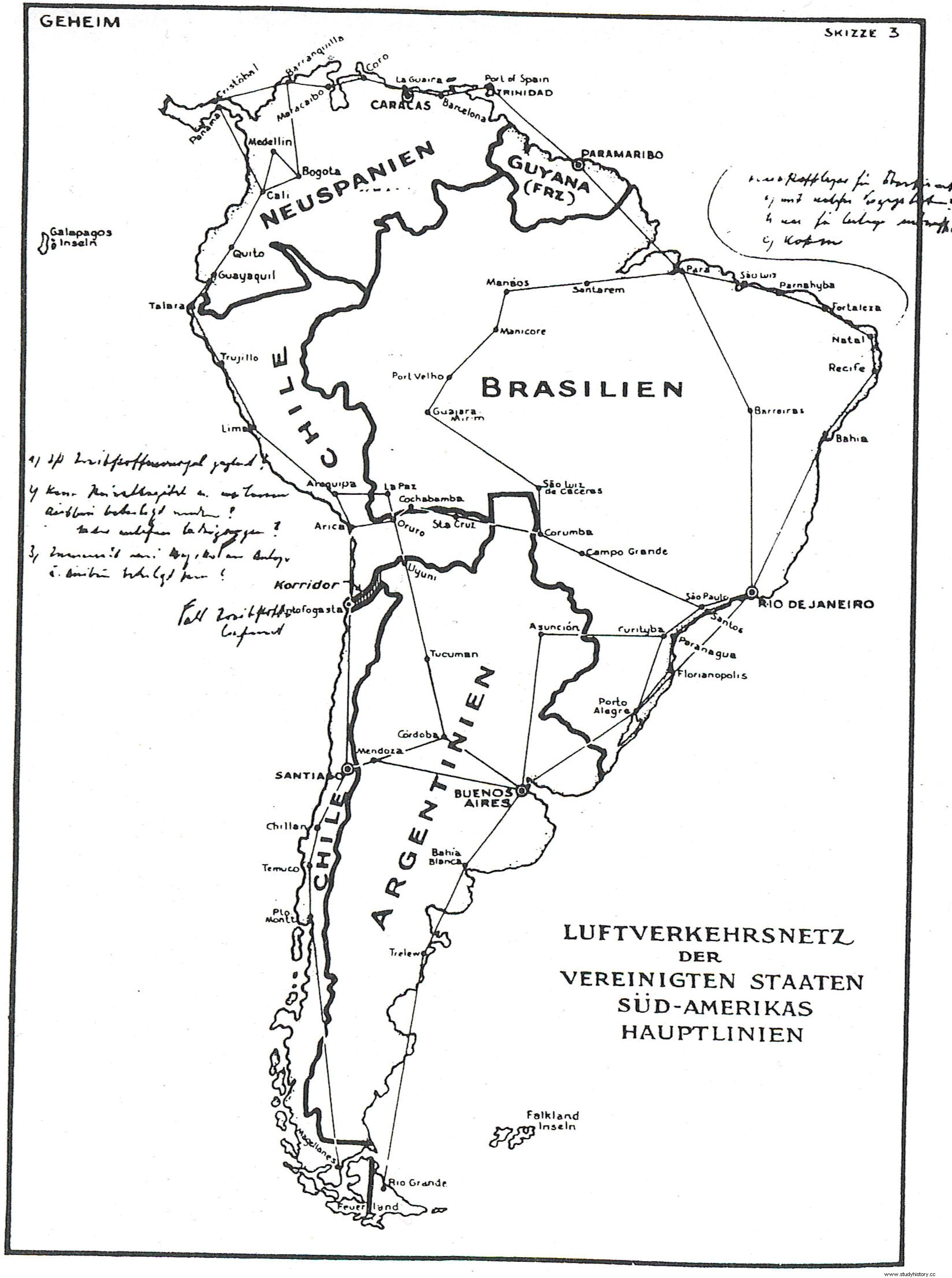
Roosevelt just needed an excuse, a very powerful and captivating one, to circumvent what was promised and enter the conflict fully. And he got it in October of that same year, 1941. In a radio address to the entire nation, he announced an extraordinary discovery. “I have in my possession,” he said, “a secret map made in Germany by Hitler's government. It is a map of South America and part of Central America, as Hitler intends to reorganize them. This map shows that the Nazis are going not only against South America but against the United States as well.”
And it is that at that time the North Americans still considered the entire continent as their backyard , referring to the Monroe Doctrine. However, the Germans denied being the authors of the map. Which did not prevent anyone from believing them and American citizens began to lean towards intervention.
The fact is that two months later Germany formally declared war on the United States, specifically based on Roosevelt's speech about the map as one of the main provocations.
Decades after the war ended, the map was found among Roosevelt's private papers and made public. But according to Nick Cull, a historian at the University of Southern California who has studied the map, it is not what it appears to be, as Mental Floss published a few days ago. Apparently it is a very good forgery. But neither the Germans nor the Americans did it.
In reality, the map was created by British intelligence . They had been pressuring the United States for a long time to enter the conflict. We had to find a way to change the direction of American public opinion, and what better than a map. Maps, says Cull, "are a well-known and incredibly powerful propaganda tool, because they capture threats with a certain level of tangibility." And furthermore, the British had the precedent of the Zimmerman telegram, which they themselves had leaked and which had led to the entry of the United States into the First World War. In the telegram, which was authentic, the Germans had promised Mexico to hand over Texas if they attacked the United States.
The map would be the work of William Stephenson, a personal friend of Churchill and in charge of British intelligence in North America in those years. It would have been based for its preparation on authentic Nazi maps of a future South America, but modifying the borders in such a way as to upset and anger the largest possible number of leaders.
According to the memoirs of one of Stephenson's team members, which apparently included Roald Dahl himself, the original plan was to leave the map somewhere in Cuba, so the FBI could find it. However, in the end it was they who took it in hand, claiming that it had been discovered in the registry of a Nazi refuge.
The only mystery that remains to be cleared up is whether Roosevelt knew of the deception. The fact is that he came in handy to achieve his goals. Cull points out that in Roosevelt's notes for his speech on the map the president had first written "I have in my possession a map of undoubted authenticity." But then he revised that line and wrote "I have in my possession a secret map". Maybe that's a clue. Nor was it a matter of openly lying to its citizens.