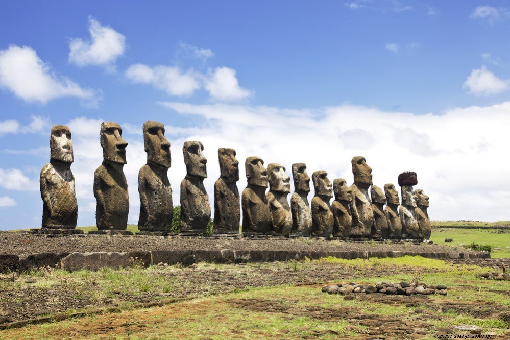
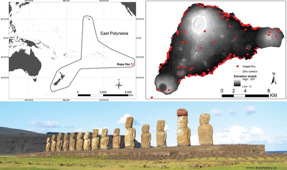
The island of Rapa Nui (Easter Island) is famous for its elaborate ritual architecture, especially the many moais and the monumental platforms that support them, called ahu. Precisely one of the main unknowns that remain unsolved is why they chose those places around the island to build them, some certainly far away, and with the consequent effort required.
Now, a team of researchers including Binghamton University anthropologist Carl Lipo has conducted a new study using quantitative spatial modeling to explore potential relationships between ahu construction sites and subsistence resources, namely agricultural rock gardens, marine resources and freshwater sources, the three most important resources on Rapa Nui. Their results suggest that the locations of the ahu are explained by their proximity to the island's limited freshwater sources.
According to Lipo the availability of water (or lack thereof) has been frequently mentioned by researchers working on Rapa Nui . The team found a strong pattern in this regard when surveying the western part of the island. Lipo continues:When we began to examine the details of the hydrology, we noticed that access to fresh water and the location of the statues were closely linked. It wasn't obvious from walking, with the water surging onto the shoreline at low tide, one doesn't necessarily see obvious signs of water. But as we began to look at the areas around the ahu, we found that those places were exactly associated with the points where fresh groundwater emerges – largely as a diffuse layer flowing out at the water's edge. The more we looked, the more consistently we saw this pattern. Sites without ahu/moai did not show fresh water. The pattern was surprising in its consistency. Even when we find ahu/moai in the interior of the island, we find nearby sources of drinking water. This paper reflects our work to show that this pattern is statistically robust and not just our perception.
The lead author of the study, Robert DiNapoli of the University of Oregon, says that many researchers, including ourselves, have long speculated on associations between the ahu/moai and different types of resources, for example, water, agricultural land, areas with good marine resources, etc., however these associations have never been quantitatively tested or shown to be statistically significant. Our study presents quantitative spatial models that clearly show that ahu are associated with freshwater sources in a way that they are not associated with other resources.
According to Terry Hunt of the University of Arizona, the monuments and statues are located in places with access to a critical resource for islanders on a daily basis:fresh water. In this way, the monuments and statues of the ancestors of the islanders reflect generations of exchange, perhaps daily, centered on water, but also on food, family and social ties, as well as on the cultural tradition that reinforces the knowledge of the precarious sustainability of the island. And this points to a critical point in explaining the island paradox:despite limited resources, the islanders succeeded in sharing activities, knowledge, and resources for more than 500 years until European contact interrupted their lives with disease. , the slave trade and other misfortunes of colonial interests .
The researchers only collected data for the western part of the island, but plan to do a full study that will definitively test their hypothesis of the relationship between ahu and fresh water.