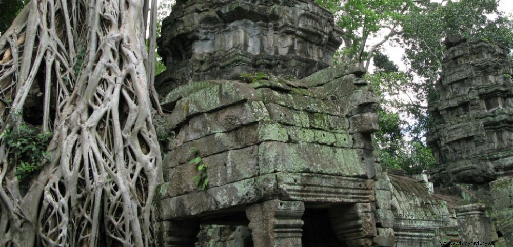
 The Ta Prohm temple (12th century), Angkor.
 SPAN. “No! We have not "discovered new unknown cities" in Cambodia, as we can read all over the world at the moment! That's not what was said ”, protests from Siem Reap (Cambodia) Jean-Baptiste Chevance (ADF*), one of the archaeologists involved in recent research carried out in the country by members of the French School of the Far East (EFEO) , and published on June 13 in the journal Journal of Archaeological Science . What the work of his Australian colleague Damian Evans (EFEO), with whom he collaborates, has just revealed during a conference at the Royal Geographic Society of London, it is a larger scale of the urban complexes of the Khmer Empire (IX th century-XV th century) than those discovered since 2012 thanks to the first Lidar campaigns. “The novelty of this work is to show that we are facing a larger urban grid than we previously imagined .” An influence that extends around the famous temples of Angkor, classified as World Heritage by Unesco, but also the neighboring cities.
900km 2 were flown over against 30 km 2 in 2012
These results were obtained using Lidar, an airborne laser scanning technology that allows you to “see” through the forest canopy using a high-frequency beam that picks up millions of points in 3D. “In the end, we only knew the visible and lasting remains, that is to say the brick temples, or the stone mountain temples , continues the specialist. In 2012 and within a consortium of eight international teams, in addition to the sites of Angkor and Koh Ker, we were only able to finance the overflight of an area of 30 km 2 on Phnom Kulen centered on the most famous monuments and sites .” But funding from the European Research Commission released in 2015 has made it possible to extend this research to a completely different scale on the Kulen massif, north of Angkor (see map ).
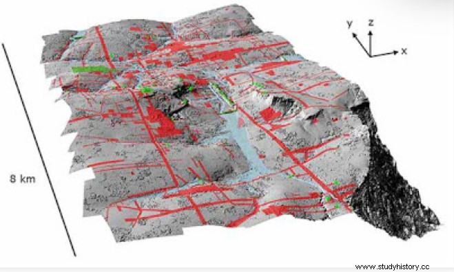 The city of Mahendraparvata rediscovered in 2000, under the vegetation of Phnom Kulen, north of Angkor. In green, the structures and sites known before the 2012 Lidar, in red, those discovered after. © ADF/KALC
“This time we went to 900 km 2 Lidar overflight. This explains the magnitude of the results. ” The acquisition of 2015 data carried out in close partnership with the Cambodian authorities (the Ministry of Culture and Fine Arts and the Apsara National Authority) also includes the study of several sites, including the pre-Angkorian capital of Sambor Prei Kuk, the great Preah Khan complexes of Kompong Svay and Banteay Chmar or the post-Angkorian capitals of Oudong and Longvek, not far from Phnom Penh.
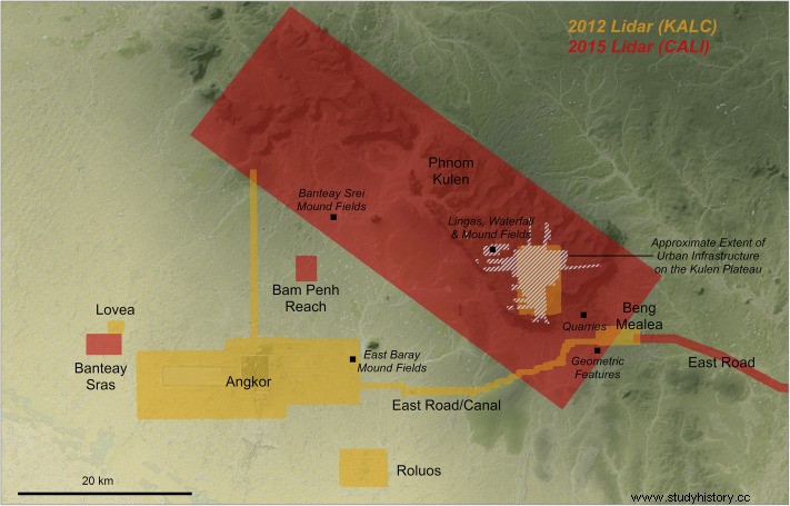 Map of the 2012 (KALC) and 2015 (CALI) airborne campaigns. 30 km
2
past explorations at 900 km
2
for the Phnom Kulen area alone. © EFEO
Map of the 2012 (KALC) and 2015 (CALI) airborne campaigns. 30 km
2
past explorations at 900 km
2
for the Phnom Kulen area alone. © EFEO
In the study published by the journal Journal of Archaeological Science, the archaeologists expose in detail the new cartography of the region. “The Lidar reveals residual traces of past societies:plots, basins, dykes, mounds, platforms, hydraulic structures… All hidden under the vegetation and which bring coherence to all the monuments and great religious sanctuaries that we know », adds Jean-Baptiste Chevance.
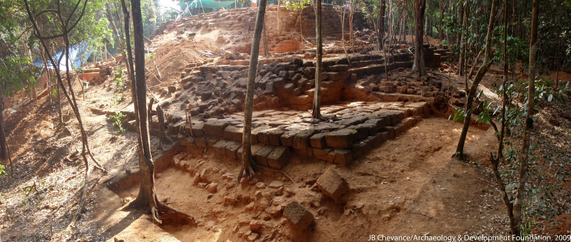 The Rong Chen mountain temple rediscovered in the Phnom Kulen massif. Photo 2009 © Jean-Baptiste Chevance/ADF
The latest data also describes the true dimensions of the city of Mahendraparvata, built by the ruler Javayarman II, in the 9 th century, in the Phnom Kulen massif (the lychee mountain). A site “rediscovered” in 2000 by Jean-Baptiste Chevance, after it had been mentioned at the end of the 19 th century by French explorers Étienne Lunet de La Jonquière and Louis Delaporte; in the 1930s, by Philippe Stern, then curator at the Musée Guimet, in Paris, or studied from an ethnographic point of view, by Jean Boulbet, between 1965 and 1968. Far from the fantasized “lost city”. A lot of data is still being analyzed. More maps are expected to be released in the coming months.
* ADF:Archeology and Development Foundation, NGO associating archeology and development.