Despite the fact that Machu Picchu monopolizes the world's media and tourist attention massively on the Andean zone, it is extraordinarily rich in historical heritage and abundant archaeological sites can be found scattered throughout the countries that make it up, from the Cañarí ruins of Ingapirca (Ecuador) to the great Inca constructions or the huacas Peruvian Mochicas, passing through the monumental legacy of Tihuanacos, Mochicas, Chimú, Lambayeques, Paracas, Aymaras, etc. Of all of them, there is one that is unfairly little known, since it boasts a double singularity:that of bringing together three cultures (Chané, Inca and Spanish) and that of being the largest cave architectural work in the world. We are talking about the Fort of Samaipata, in Bolivia.
It is located in the Department of Santa Cruz, 8 kilometers from the small municipality that gives it its name, occupying the top of a hill at an altitude of 1,950 meters. Santa Cruz, an inland region of the country, borders the Paraguayan Chaco and two of the wildest areas of Brazil, Mato Grosso and the Amazon. In fact, it is also found in the foothills of the Amboró National Park, a place popularly known as Elbow of the Andes because that's where this mountain range changes direction to the south.

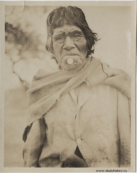
Therefore, it constitutes the last Andean mountainous stretch and in its time it was practically the eastern border of the Inca Empire, straddling the extreme northeast of Collasuyu and the southeast of Antisuyu (which together with Chinchaysuyu and Constisuyu, made up the four of its or regions in which said empire was divided, the Tahuantisuyu). However, Fort Samaipata is pre-Inca. It was built by the Chané, a people of Guarani origin, of Arahuaca ethnicity, who also occupied the western part of Paraguay and the northwest of Argentina.
The Spanish called it chiriguano, a word that was an adaptation to Spanish of the derogatory nickname that the Quechuas had given them:chiri wanu , which means something like "cold excrement", although another version says that it would be chiri wañuq ("those who die in the cold"). The fact is that the Chiriguanos or Ava Guarani were subdivided into three branches and one of them was the Chané, whose current representatives claim that ancestry along with the original Arawak (from the northern area of South America, in what are now the Guyanas). In Bolivia they are also called Izoceños, because they occupy the Izozog region.

Although their culture was not as advanced as others in the subcontinent, after that emigration they became sedentary, occupying a territory probably previously populated by the mojocoyas, so that in addition to hunting and fishing they practiced agriculture, developing complex irrigation systems that are still used today. , given the drought that grips that part of Bolivia six months a year. As archaeological evidence there have been samples in Valle Abajo, Mairana, Portachuelo, Okinawa, Cotoca, in addition to Samaipata, with good pieces of ceramics, fabrics, masks, tools...
It is possible that the aforementioned mojocoyas did the first works on the top of the hill around the 3rd century AD. In any case, archaeologists now consider that the Chané were the main authors of the fort. Which, by the way, is not. It is not a polyorcetic construction -or, at least, not exclusively-, since it also had religious use, something that in pre-Columbian America also implies astronomical observation. In fact, Samaipata is a name of Quechua etymology that means "place of rest between the mountains", which does not seem to be related to a defensive function and surely derives from its difficult access.

Part of the confusion is due to the fact that the later occupants, the Incas, added residential structures (a plaza, dwellings…) to the ceremonial ones. The Chané were not based in a geographical location that was exactly comfortable from a strategic point of view. They were able to maintain diplomatic relations with the Quechua but later they would find themselves between their backs and the wall, with the Incas on one side and the Guarani on the other. The former established a settlement near Samaipata to stop the latter, who used to carry out aggressive raids.
However, this obstacle, agreed between the Inca prince Gaucane and the Chané ruler Grigotá, could not resist the Guarani thrust, which in a wave of invasion took over the valley, enslaving the Chané but causing widespread miscegenation by marrying their women ( Curiously, there is talk of mass rape, as would later be done with respect to the Spanish, which actually goes to show that the uses of war have been very similar everywhere), so that with the passage of time that Arawak people was transformed in the chiriguano It was the one found by the Spanish in the 16th century, coexisting with new Inca settlements, who had incorporated new constructions into Fort Samaipata.
The Spanish also added facilities to the site providing the tricultural aspect that it presents today. However, they left those places to move to a nearby valley because the Guaraní onslaughts continued and, in that new place, Captain Pedro Lucio Ecalante y Mendoza founded the city of Samaipata. It was the year 1618 and he did not baptize it with that name but with the City of the Valley of the Purification of the Holy Virgin, which would later be known simply as Castilla.

It was the same point where Guanacane had been established with his troops between 1471 and 1493, during the final stage of the Túpac Yupanqui period, the last great imperialist expansion, after convincing Grogotá to become a tributary of the Sapa Inca. It was a defensible place, being on top of a 1,610-meter-high summit, and Sabay Pata, as he himself named it, became the local capital, protected by a series of peripheral bastions, some of which are still preserved. (The Fortress, Guanacopampa…). The war between the Incas and the Guarani took place in the second decade of the 16th century and it is not known how it ended; not even if he did, since that was when Pizarro arrived in Peru, according to the eighteenth-century chronicler Diego Felipe de Alcaya.
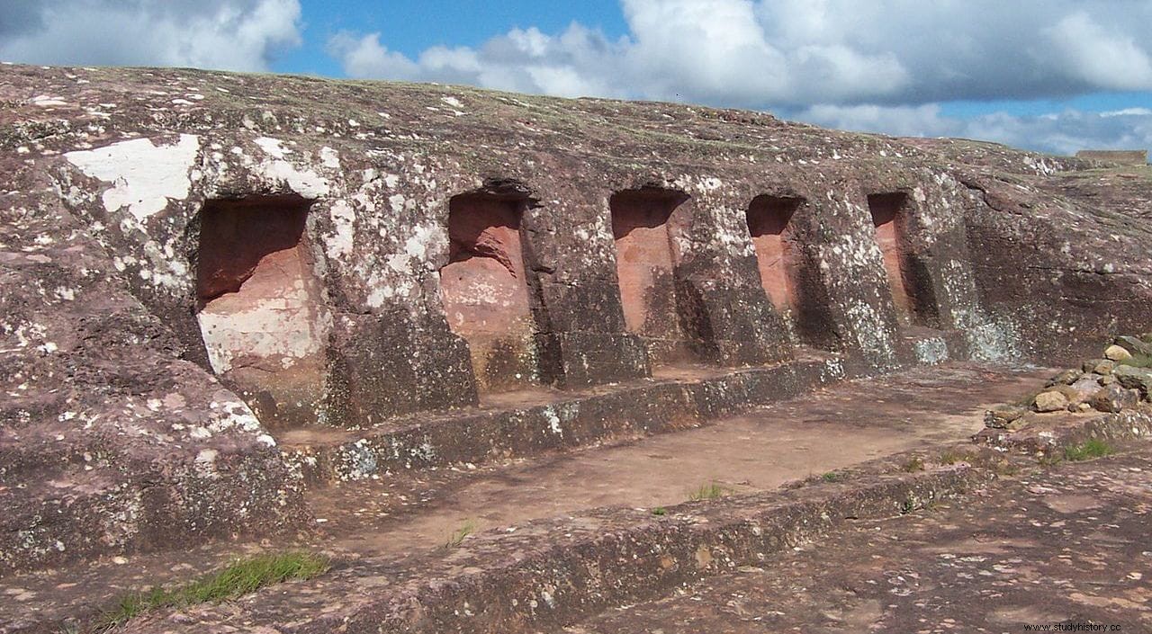
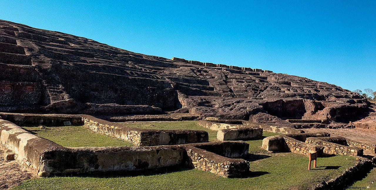
And what is in Fort Samaipata? Its 20 hectares of surface are divided into two different parts, the ceremonial and the administrative-residential. The first is located in the northern part of the hill, which has been baptized -quite appropriately- as Cerro Esculpido. It measures about 220 meters long by 60 meters wide and is made up of a large rocky sandstone outcrop carved with geometric and faunal motifs, to which niches, channels and other carvings are added, making it the largest petroglyph in the world.
The highest point, called Coro de los Sacerdotes, consists of 18 niches carved into the stone that were probably seats (hence the name) and further on there are another 21 rectangular ones whose use is uncertain, speculating that they would be storehouses for objects. used in rituals. The second part, located on the south face of the hill, is made up of various structures, the most prominent of which is a square with a trapezoidal floor plan that measures about 100 x 100 meters and is bordered by buildings.

One of them is the Kallanka, common in Inca cities, which was used for public meetings, parties and mass events, hence its considerable size (70 meters long by 16 wide), although it was left unfinished when it perished. Another important building is the Acllahuasi, a kind of convent (or so the Spaniards saw it) where the acllas were concentrated. o Virgins of the Sun, young people from the entire region, with various possible purposes:working for the state making textiles or chicha, marrying warriors and notables, or being sacrificed.
In that area there is also the Colonial House, from the Spanish period and Andalusian style (with a central patio) and several Inca structures, which is why this forum is called Plaza de las Tres Culturas. A little further down the hill is a corner called kancha , made up of several individualized small pavilions with perimeter walls. Overflow of visitors and erosion have deteriorated many of these sites, forcing Stonewatch, the non-profit entity that manages them, to cordon them off. After all, Fort Samaipata is part of the UNESCO World Heritage Site.
