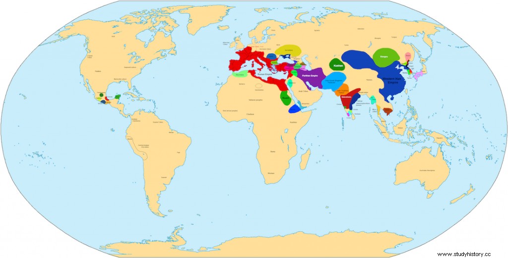
There are never too many interesting maps. Here is another one. 100 BC world map. See what the ancient world looked like 100 years before the birth of Jesus Christ. Political map of the ancient world.
Often, when we think of the ancient world, we only see it in the context of the ancient states of the Mediterranean and the Middle East. And it was not only in this region that developed civilizations arose. We can also find traces of them in East Asia and America. A Wikipedia user decided to create a world map depicting the political situation in 100 BCE. As you can see on the map, the Roman Republic now controls almost the entire Mediterranean Basin. It seems that the Empire of Rome is territorially comparable to the Chinese Empire of the Han Dynasty.

World Map 100 B.C.E. - Source:commons.wikimedia.org Author:Javierfv1212
The map above contains many names in small letters. To see the details, it's best to view it in better resolution. The map in higher resolution (4000 × 2036) is available at this link.
See also:
- Animated map of the history of civilization
- Animation of the development of the human population for 2000 years
